by CCCL Intern
Congress passed the Biggert-Waters Flood Insurance Reform Act just two months before Sandy scoured the northeast, and “requires rates to rise 25 percent annually on some repeatedly flooded houses, second homes and businesses,” and on properties where the costs imposed by past floods exceed the property’s selling price. The bill was a response to Hurricane Katrina’s damaging effect on the National Flood Insurance Program (NFIP) balance sheet (consistently bankrupt), and it sought to make homeowners who choose to remain in risky areas bear a greater share of the costs of insuring their property.
In the aftermath of Superstorm Sandy, though, lawmakers attempted to forestall the scheduled rate hikes; the House passed an amendment to the bill that would hold rates in place for one year, but the measure has stalled in the upper chamber.
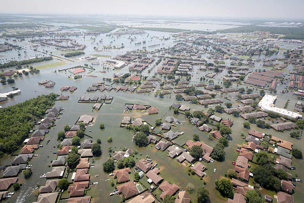
Meanwhile, the Federal Emergency Management Agency (FEMA) has released revised flood plains maps for the New York region. The new maps are based on historical data, representing a “snapshot” of the current flood risk without considering future events like sea-level rise or an increasing chance of heavy downpours. Mayor Bloomberg has provided a fuller picture in the recently released flood maps included in his plan, “A Stronger, More Resilient New York”, and in his statements at the press release for that same plan: “We expect that by mid-century, up to one quarter of all New York City’s land area, where 800,000 residents live today, will be in the floodplain…If we do nothing, almost a tenth of our waterfront—more than 40 miles or so—could see flooding on a regular basis, just during normal high tides.”
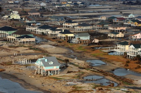
The old FEMA maps were last updated in 1983, nearly three decades before, and the new maps accordingly show a sweeping change in the threat level. Many homeowners now find themselves in high risk “A” or “V” flood zones, and that designation will give them two options: restore the house to pre-Sandy condition and face steep rate increases in insurance, or raise the house above the flood plain, perhaps by placing the home on stilts. The cost of elevating a house can be prohibitive, even with financial assistance from federal funds, especially for low-income coastal residents.
In his State-of-the-State address, New York Governor Andrew Cuomo joked that New York “has a 100-year flood every two years now.” His facetious comment reflected sentiments about the baleful potential of climate change, but there are those in the affected communities who believe that things can get no worse. Many believe that Sandy’s coming relatives will not match her destructive intensity, leaving them another option: stand put, ignore the new flood maps, and remain in the putative danger zone. That course may be available if the mortgage on the house is not federally backed, and if the home’s owner is at peace with the prospect of gutting its resale value. The other option is to walk away from the home, with its attendant premiums and mortgage considerations, but for many of the proud residents of the affected communities, that’s no choice at all.
For these homeowners, so much depends on what FEMA has done, and what Congress will do next. But whatever happens, it is clear that they will wrestle with Sandy’s legacy a while longer.